![]()
![]()

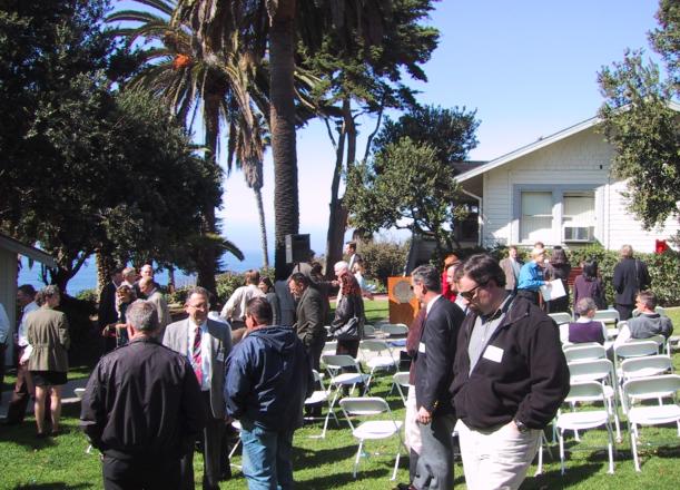
CSRC Headquarters Dedication: February 20th, 2001
Article below featured on the front page of the North County Times, on February 19, 2001.
Written by Katie Burns. Embedded photos by Matt VanDomselaar.
New Center Will Tell People Where They Are
LA JOLLA—A coalition of private and public agencies on Tuesday will open a new center at Scripps Institution of Oceanography that eventually will allow anyone to pinpoint the location of everything from cliffs to cars for mapping and navigation. The agencies plan to use the new California Spatial Reference Center's network of sensors to generate data so that people building a road or piloting a boat could avoid obstacles from underground pipes to underwater reefs.
The center will publish the data, to be compiled in a universal reference system, on the Internet. At first, surveyors and engineers will use the ability to precisely determine locations to make better maps for building bridges and buildings. Later uses of the network might be guiding highway traffic or landing airplanes via continually updated wireless networks. "There are a lot of applications, and we keep thinking of new ones all the time," said Yehuda Bock, the new center's director. "Anything that has to do with position and change in position over time would be a candidate."
About 50 groups ---- including the California Department of Transportation, the Metropolitan Water District of Southern California, the California Coastal Commission and the California Land Surveyors Organization ---- are founding and funding the center, which will start out with $1 million. The backbone of the center is the network of 239 sensors throughout the state built by scientists to measure movement of land along faults, which causes earthquakes. The sensors communicate with the Global Positioning System, a system of satellites that measures the travel time of radio signals to identify points on the planet's surface, to determine their location to within an inch, as opposed to yards for hand-held GPS devices.
By communicating with the sensor network, portable receivers in cliffs or cars also could determine their location very precisely. "The surveying and engineering communities came up with the idea of forming this center, which would then take advantage of the infrastructure that's been put in by the scientific community, which would provide information for nonscientific users of the data," Bock said.
RBF Consulting, an engineering firm with offices in Temecula and San Diego, is one of the organizations hoping to take advantage of the center. Greg Helmer, the vice president of GPS services for the company and a vice chairman for the center, said the precise positioning system will be helpful for a project for the Riverside Transportation Authority. RBF Consulting is gathering location information about faults, roads, buildings and other objects for several agencies that are rewriting the area's transportation plan. The data comes from various sources, such as aerial photos, employees on the ground and the U.S. Geological Survey. "We're assisting in bringing dissimilar information together," Helmer said. "The center provides accurate and current models that allow us to relate the different coordinate systems and elevation systems. In this fashion, with the center, we're collecting that type of information in a central location and distributing it over the Internet to users in a very current and accurate form."
Many of those users will still be scientists. Ken Hudnut, a Geological Survey geophysicist in Pasadena, said the network is only recently complete and scientists hope to use it for as long as possible to study the exceedingly slow motion of the Earth along faults, which is originally what made such precise location data necessary.
But the center will expand the scope of the network both physically—filling in areas of the state far from faults where sensors are sparse—and ideologically. "It's taking what otherwise might be a purely academic-type research and making the data available to a wide variety of applications," Hudnut said.
Hudnut said the center is the result of the enthusiasm of its potential users, including retired surveyors such as center Chairman Bill Young, who headed the Riverside County Flood Control and Water Conservation District. Bock said the center is obtaining most of its funding from government bodies at the federal, state and local level because its leaders want to provide free public access to the location information instead of being pressured by private interests to charge fees. Contact North County Times staff writer Katie Burns at (760) 740-5442 or via email at kburns@nctimes.com. The California Spatial Reference Center can be reached at (858) 534-8031 or archive@csrc.ucsd.edu