
![]()

Welcome to the California Spatial Reference Center
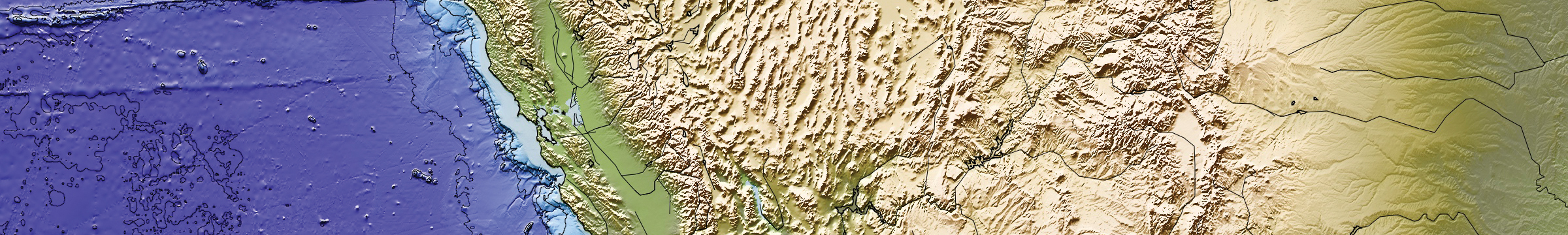
The California Spatial Reference Center (CSRC) is responsible for “Establishing and maintaining an accurate state-of-the-art network of GPS control stations for a reliable spatial reference system in California.”
News 4/10/2025: New CRTN Excel worksheet (1) Add new DWR stations HANF,Q174,Q213 with CSRS Epoch 2017.5 coordinates; (2) Moved DWR stations MABY,R108,YCFC to zone 1-2; (3) Fixed server and zone headers
Update CSRS Epoch 2025.00 project: Under contract to Caltrans, CSRC will be publishing a new epoch date in the next few months. CSRS Epoch 2025.00 is processed in ITRF2020 and will be aligned with NAD83(2011) as is CSRS Epoch 2017.5. When the modernized National Spatial Reference System is published, CSRC will also provide Epoch 2025.00 coordinates for that (see NGS for more details regarding NSRS - Track Our Progress | New Datums | National Geodetic Survey).\
News 3/7/2025: New CRTN Excel worksheet (1) Updated IP/port numbers for CRTN Zone 5 and Zone 3-4; (2) Added new Department of Water Resources stations (MABL,R108,YCFC); (3) Caution: added comment on a subset of stations that have different Epoch 2017.5 NAD83(2011) coordinates - see column T in spreadsheet]
News 3/7/2025: CSRC plans to move CRTN Zones 6 and 1-2 to our new server. We will post and e-mail CRTN users with the new IP/port numbers when this is completed.
Announcement for CRTN Zone 3-4 users 11/11/2024
We are transitioning to a new server/software for CRTN Zone 3-4 on Friday evening, November 22. Full GNSS data streams are available for those stations as indicated on the CRTN station worksheet (column G)
The new IP and port number: 132.239.152.4:2103
The new server/software is operational so you can try it out before November 22 as well. Feedback is appreciated.
Please contact Maria Turingan (mrturingan@ucsd.edu) for account issues and Rohith Rachala (rrrachala@ucsd.edu) for connection issues.

Announcement for CRTN Zone 5 users 11/01/2024
We have transitioned to a new server/software for CRTN. It provides full GNSS data streams for those indicated on the CRTN station worksheet (column G)
The new IP number is 132.239.152.4 (still port 2104), previously 132.239.154.80
Please contact Maria Turingan (mrturingan@ucsd.edu) for account issues and Rohith Rachala (rrrachala@ucsd.edu) for connection issues.
Announcement for CRTN Zone 5 users 10/17/2024
We are transitioning to a new server/software for CRTN Zone 5 on November 1. It provides full GNSS data streams for those indicated on the CRTN station worksheet (column G)
The new IP number is 132.239.152.4 (still port 2104), previously 132.239.154.80
The new server/software is operational so you can try it out before November 1 as well. Feedback is appreciated.
Please contact Maria Turingan (mrturingan@ucsd.edu) for account issues and Rohith Rachala (rrrachala@ucsd.edu) for connection issues.
News 10/6/2024: Updated Station Excel Worksheet - Added DWR stations Q143,Q160,TLBN; Disconnected rebuilt BARD (see below) stations until approximate coordinates are updated.
New 8/27/2024: New CRTN Excel Worksheet
News 8/5/2024: Upgraded CRTN Status Map

New features:
(1) Added "Decommissioned Station" layer
(2) Additional metadata when choosing a station (e.g., geoid12b geoidal heights)
(3) Added "Post-2017.5" layer - stations with epoch dates later that CSRS 2017.5 (mostly CTSRN stations). See comments in station metadata.
CRTN status map refreshes every 5 minutes
News 7/4/2024: Upgraded CRTN Status Map
New features:
(1) Improved color scheme to better distinguish between station characteristics, and between active and inactive stations
(2) View stations by subnetwork (e.g., NOTA, CTSRN)
(3) Added station velocity layer (horizontal and vertical)
(4) Added new CTSRN and DWR stations
CRTN status map refreshes every 5 minutes
News 7/4/2024: Added 2 new Department of Water Resources (DWR) Stations (HWKK and HWPP) maintained by Verquin for Psomas contract with DWR
CRTN News 3/13/2024: Updated CRTN Station Excel Worksheet; Removed stations no longer in operation; Added DWR stations Q189, Q204, Q208) and Verquin station GZKA; Removed BARD stations that were moved to new locations - they do not have 2017.5 coordinates yet.
[Caution: added comment on a subset of (CTSRN) stations that have 2019.55 coordinates rather than Epoch 2017.5 - see column T in spreadsheet]
DWR Project 2/14/2024: CSRC and Verquin have subcontracted with Psomas to install and operate a network of GNSS stations for the Department of Water Resources (DWR) to monitor crustal deformation (e.g., subsidence) at DWR aqueducts. Currently, there are three stations (Q189,Q204,Q208) operating near Lost Hills in the San Joaquin Valley. Real-time GNSS data from four constellations (GPS, GLONASS, GALILEO, Beidou) are available from CRTN in RTCM3.3 format through NTRIP protocol at a rate of 1 Hz (1 sps). RINEX data at 15s intervals are available from the SOPAC archive (username: anonymous; password: your e-mail address). Displacement time series for the DWR stations are available from MGViz.
Award 9/21/2023: SIO has been chosen as one of 4 institutions to receive an FY23 Geospatial Modeling Competition Award by NOAA's National Geodetic Survey (NGS). SIO is receiving $1,300,000 annually for a potential total of $6,500,000 over a 5-year period for a project titled "NSRS Intra-Frame Deformation Model and New SIO Geodesy Program." The primary objectives of this project are to create a formal geodesy program in support of the nationwide deficiency of geodesists and to modernize geodetic models for the NSRS.
Feature 9/19/2023: SCIP Dynamic Datum (Credit A. Knox - SOPAC)
Feature 9/19/2023: MGViz Time Series Portal (Credit A. W. Moore - JPL)
Final Epoch 2017.5 coordinates spreadsheet: (xlsx)
The CSRC was established in 1997 as a partnership with surveyors, engineers, GIS professionals, the National Geodetic Survey (NGS), the California Department of Transportation (Caltrans), and the geodetic and geophysical communities.
CRSC is a Support Group of University of California San Diego (UCSD). Support groups are an important source of financial and volunteer assistance to the university through outreach efforts and public/private partnerships. We are headquartered at the Institute of Geophysics and Planetary Physics (IGPP), at Scripps Institution of Oceanography (SIO)'s Orbit and Permanent Array Center (SOPAC). Our governing body is the Executive Committee drawn from local, state and federal government, the private sector and academia, and a Coordinating Council that meets twice a year.
The CSRC also maintains the California Real Time Network (CRTN), established in 2003 to (1) provide base station support for precise positioning (e.g., RTK surveys) and spatial referencing, (2) support research into earthquake early warning and response systems. CRTN rebroadcasts real-time data streams from multiple servers to registered users.
Past CSRC Community Notices
- December 20, 2022 10:34:24 UTC: Minimal effect on coordinates for M6.4 Ferndale earthquake, N26.43123,W140.09766; 17.9W km depth. The earthquake caused a minimal shift in coordinates - maximum horizontal offset of 0.066 ft (2 cm) at station P161, less than 1 cm at other stations in the epicentral region. No detectable vertical motions.
- March 25, 2022: The SCIP dynamic datum utility is now publicly available. SCIP allows the user to obtain coordinates within the boundaries of California between any two dates and in and between four datums: NAD83(2011), WGS84, ITRF2014 and the legacy NAD83(NSRS2007). Disclaimer: We are in the process of determining whether SCIP can be used for records of survey with respect to the California Spatial Reference System (CSRS) and consistent with the California Public Resources Code.
- October 5, 2021: In Memoriam: We are saddened by the passing of Mr. John Canas, PLS, on September 5, 2021. John served admirably as the CSRC Executive Manager from 2005-2018 and was a strong advocate for the Center’s ties to the surveying, mapping and geodetic engineering communities in California and beyond. As a California Professional Land Surveyor (No. 4408) he authorized on September 25, 2018 the report to Caltrans of the California Spatial Reference System, CSRC Epoch 2017.50 (NAD83), in accord with the California Public Resources Code and the California Professional Land Surveyor’s Act. His 43 years as a land surveyor included 15 years as the County Surveyor of Orange County. As County Surveyor, he initiated a collaboration with Scripps Institution of Oceanography’s Orbit and Permanent Array Center (SOPAC) to install the Orange County Real Time Network (OCRTN), the first such real-time GPS network in California, inaugurated in June 1994. In December 2018, at The League of California Surveying Organizations (LCSO) meeting that the CSRC co-hosted in La Jolla, John received Distinguished Service awards from Caltrans and the CSRC. CSRC’s Director and Chair of our Executive Committee were honored to attend funeral services at the St. Vincent De Paul Church in Huntington Beach on September 27th, where we learned that John served in the Vietnam War as an interpreter, having mastered the Vietnamese language. We extend our sincere condolences to John’s wife, Winona Canas, and their extended family. John was a talented, demanding but fair, gentle, and forward-looking giant of a man. He was a real friend to the CSRC, and we will miss him.
- August 7, 2021: Dynamic Datum: The CSRC is developing a dynamic datum for California that allows users to seamlessly transition positions (coordinates) between any two epoch dates in several California Spatial Reference System (CSRS) reference frames by taking into account motions due to tectonic, earthquake, subsidence and other physical processes. Building on a journal publication on the subject, Caltrans contracted with CSRC to further develop the concept described in a report "Investigations into a Dynamic Datum for California." In July 2020, CSRC delivered a study "Scoping Study for Intra-Frame Velocity Model (IFVM) for the United States" to NOAA's National Geodetic Survey on applying the dynamic datum concept to an IFVM for the upcoming modernized National Spatial Reference System. Currently under contract to Caltrans, CSRC is developing a dynamic datum web utility (SCIP), now in beta testing.
- October 17, 2019: Recognition of Chris Walls, UNAVCO/NOTA Southwest Project Manager at CSRC Coordinating Council Fall Meeting in Sacramento. An excerpt: "Without the contributions and partnership of UNAVCO, realized through the tireless efforts of Mr. Walls and the UNAVCO staff, the California Geospatial Community would not have access to the robust geodetic infrastructure that exists today in the form of the CSRN and CRTN. On behalf of that community, and the CSRC, we extend a heartfelt thank you to Chris, UNAVCO and the National Science Foundation."
- June 26, 2019: Scott P. Martin, CSRC Executive Committee member and California Geodetic Coordinator for the National Geodetic Survey, was recognized as an "NGS Partner" with an accompanying NOAA commemorative disk "in recognition of his significant and much-appreciated contributions to the geospatial community."
- December 14, 2017: California’s GIS Council endorses the recommendations of the report “Maintaining California’s Geodetic Control System Strategic Assessment” prepared by the Geodetic Control Working Group.
- February 26, 2018: Endorsed by League of California Surveying Organizations (LCSO)
- March 28, 2018: Endorsed by County Engineers Association of California (CEAC)
- April 9, 2018: Endorsed by American Council of Engineering Companies California (ACEC)
- April 27, 2018: Endorsed by California’s Land Surveyor’s Association (CLSA)
- April 30, 2018: Endorsed by Urban and Regional Information Systems Association (URISA)
- May 5, 2018: Endorsed by Esri
- CRTN transitioned to CSRS Epoch 2017.50 (NAD83) on March 1, 2018.
- The CRTN Southern California server has a new IP (updated February 6, 2018): 132.239.154.80
- The CRTN Northern California server has a new IP (updated August 5, 2017): 132.239.152.175
- CRTN Registration: Allow 7-10 days for an account
- Give a Gift to CRTN
![]()
SIO receives FY 23 Geospatial Modeling Competition Award with CSRC Director Yehuda Bock as principal investigator (September 21, 2023)
CSRC Director Yehuda Bock receives CSRC Founders Award (April 2023)
CSRC Strategic Plan/Decade 3 published (2021-08-31)
![]()
SIO receives FY 23 Geospatial Modeling Competition Award with CSRC Director Yehuda Bock as principal investigator (September 21, 2023)
CSRC Director Yehuda Bock receives CSRC Founders Award (April 2023)
CSRC Strategic Plan/Decade 3 published (2021-08-31)
![]()
CSRC News
January 14, 2022: Members of the Executive Committee briefed the California Department of Water Resources (DWR) on the importance of a geodetic datum, the California Spatial Reference System (CSRS), and InSAR/GNSS high-resolution displacement grids to DWR's responsibilities for the safety of life through clean water delivery, the safety, longevity and upgrading of critical-water-infrastructure, groundwater use management and flood control.
September 20, 2021: CSRC Director Bock gave an invited talk on the dynamic datum and video at the 61st meeting of the Civil GPS Service Interface Committee.
June 16, 2021: The CSRC 2017.50 map is now accessible via QR code. Use the QR code below. (If needed, instructions are available here.)

May 6, 2021: Datum Epochs, And How to Understand Them is now available online.
January 15, 2020: The CSRC Policies (pdf) and Bylaws (pdf) are now available online.
December 29, 2019: Overview of geodetic datums: Epoch Date vs Kinematic
August 30, 2019: Update on Ridgecrest July 4 and 6, 2019 earthquakes. Details. Download coseismic offsets (corrected 11/4/2019). Download Epoch 2019.55 coordinates for affected stations.