
![]()
![]()

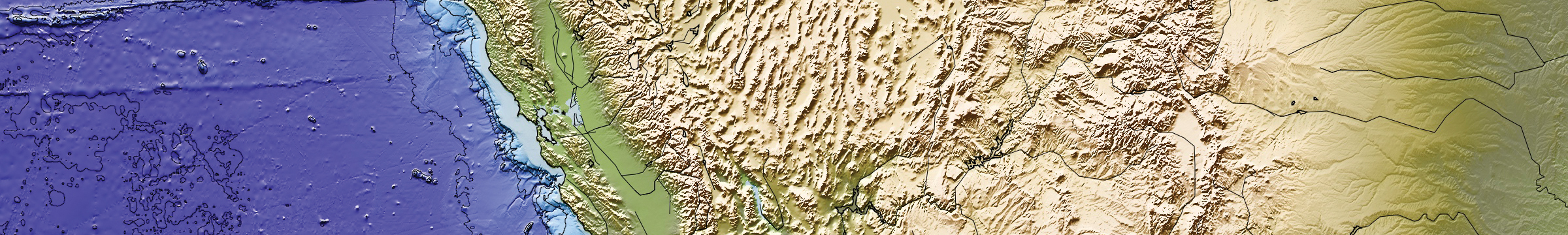
SCIP Utility
SCIP Dynamic Datum (Credit A. Knox - SOPAC)
Maintaining a datum for California requires consideration of steady and transient, horizontal and vertical, motions of the reference stations making up the California Spatial Reference Network (CSRN). These motions may be due, for example, to crustal deformation and tectonic processes, earthquakes, groundwater extraction and recharge, drought and magmatism.
CSRC has been using the epoch-date approach to define and maintain the California Spatial Reference System (CSRS). The latest published geodetic datum is CRSC 2017.5 (NAD83). Epoch 2017.50 is related to the current definition of the National Spatial Reference System (NSRS) through a set of coordinate transformations from ITRF2014 to NAD83(2011), published by the NOAA/NOS National Geodetic Survey (NGS).
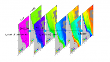
Under contract to Caltrans, CSRC investigated a "dynamic datum" to replace the Epoch-date approach, described in the report "Investigations into a Dynamic Datum for California." In a follow up project, we have developed the SCIP utility as a realization of the dynamic datum concept, illustrated in the figure. SCIP allows the user to obtain coordinates within the boundaries of California between any two dates and in and between four datums: NAD83(2011), WGS84, ITRF2014 and the legacy NAD83(NSRS2007). Note that WGS84 and ITRF2014 are equivalent, except that ITRF2014 is an Earth-centered frame, while WGS84 is just the ITRF2014 (X,Y,Z) coordinates transformed to geodetic latitude, longitude and ellipsoidal height using the WGS84 ellipsoid parameters.
References
Bock, Y. & D. Melgar (2016), Physical Applications of GPS Geodesy: A Review, Reports on Progress Physics, 79, 10, doi:10.1088/0034-4885/79/10/106801.
Bock, Y., P. Fang & G. R. Helmer (2018), California Spatial Reference System: CSRS Epoch 2017.50 (NAD83), Final report to California Department of Transportation (Caltrans), January 4.
Bock, Y. & E. Klein (2018), Investigations into a Dynamic Datum for California, Final report to California Department of Transportation (Caltrans), June 22.
Bock, Y. & S. Wdowinski (2021), GNSS Geodesy in Geophysics, Natural Hazards, Climate, and the Environment, in Position, Navigation, and Timing Technologies in the 21st Century: Integrated Satellite Navigation, Sensor Systems, and Civil Applications, IEEE, 2021, 741-820, doi: 10.1002/9781119458449.ch28.
Bock, Y., E. Klein, A. M. Moore, X. Xu, D. T. Sandwell, P. Fang, D. Golriz, D. Argus, Z. Liu, S. Kedar (2019), Kinematic Reference Frame for the Crustal Deformation Cycle: Transients and Model Discrepancies, Abstract G32A-06, presented at 2019 Fall Meeting, AGU, San Francisco., 9-13 Dec.
Klein, K., Y. Bock, X. Xu, D. Sandwell, D. Golriz, P. Fang, L. Su (2019), Transient deformation in California from two decades of GPS displacements: Implications for a three-dimensional kinematic reference frame, J. Geophys. Res., https://doi.org/10.1029/2018JB017201
Zeng, Y., and Shen, Z.‐K. (2017), A fault‐based model for crustal deformation in the western United States based on a combined inversion of GPS and geologic inputs. Bulletin of the Seismological Society of America, 107(6), 2597–2612. https://doi.org/10.1785/0120150362
![]()