


Products Overview
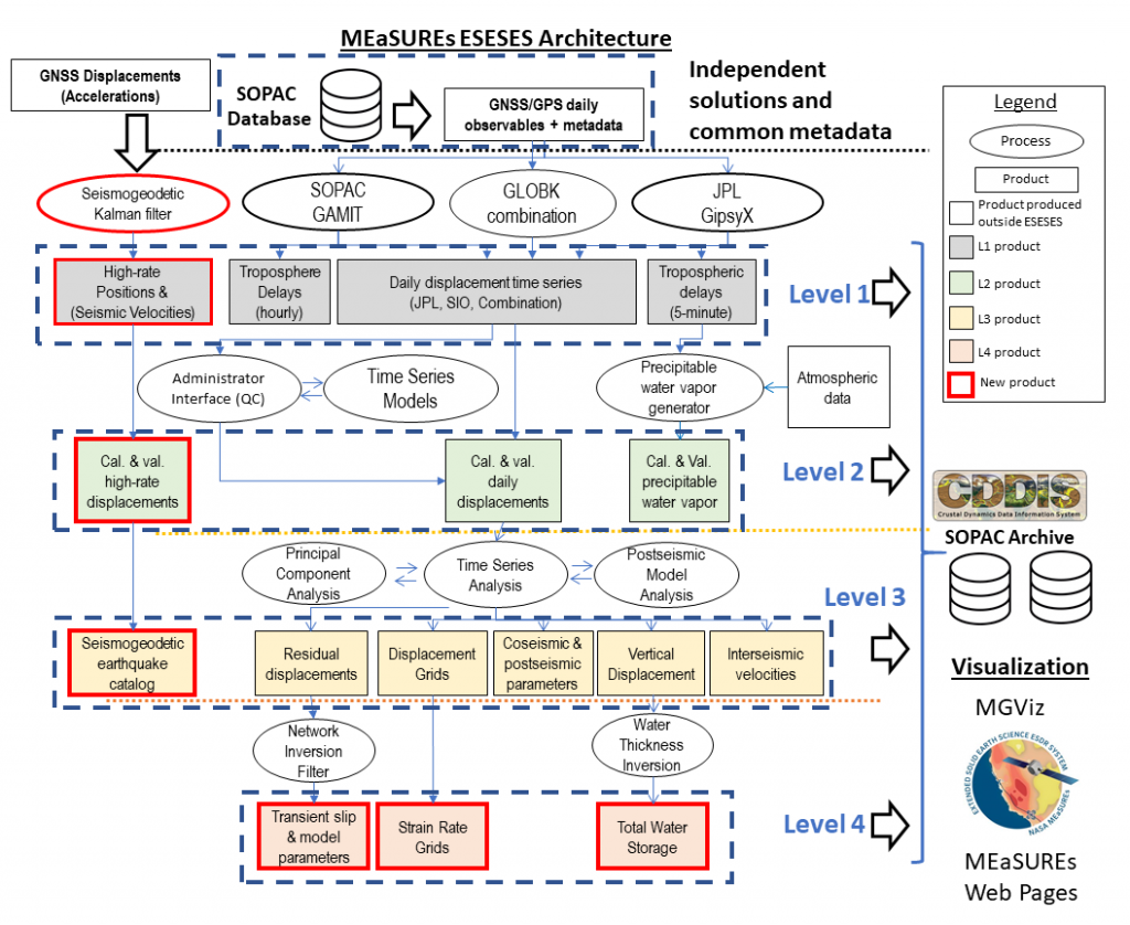
The MEaSUREs ESESES project provides a hierarchy of Earth Science Data Records (ESDRs) based on data from thousands of GNSS stations, focusing on crustal deformation at tectonic plate boundaries, transients, natural hazards, near-surface water storage and atmospheric water vapor. See also our project's ATBD, which provides a detailed description our products. ESESES products are archived at CDDIS and SOPAC.
Hierarchy of ESESES Products
Daily displacement time series
Station velocities
Displacement Grids
Strain Rate Grids
ETS Transients
Seismogeodetic Earthquake Catalog
Troposphere
Hydrology: Total Water Storage